Jump to Content
Contributing Institutions
Collection Guides
Browse Map
About OAC
What are Collection Guides?
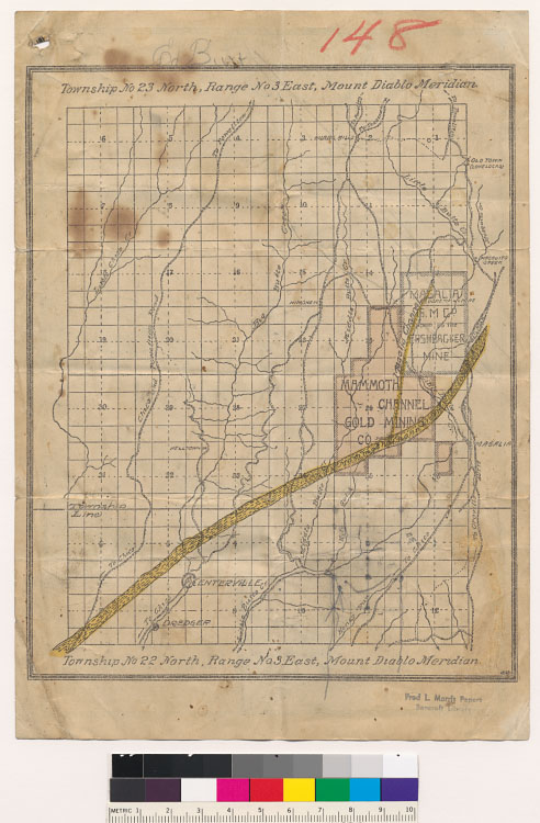
Map showing part of State of California also location of Mammoth Channel and Magalia Mines [Collection of mining maps of Butte County, California]
[Townships No. 22 and 23 North, Range No. 3 East, Mount Diablo Meridian; showing Mammoth Channel and Magalia (Pershbacker Mine) Gold Mining Companies]
Click image for larger view
previous
image only
image with details
Title:
[Townships No. 22 and 23 North, Range No. 3 East, Mount Diablo Meridian; showing Mammoth Channel and Magalia (Pershbacker Mine) Gold Mining Companies]
Local Call Number:
Map G 04363 B8 H1 SVAR M6 no.5 Case A Bancroft [verso]
Filename:
cubanc_1_2_00008380a.tif
From:
Map showing part of State of California also location of Mammoth Channel and Magalia Mines [Collection of mining maps of Butte County, California]
Contributing Institution:
The Bancroft Library, University of California, Berkeley, CA 94720-6000;