Courtesy of UC Berkeley, Bancroft Library
Title:
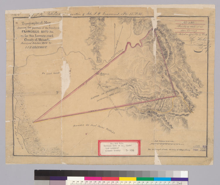
Topographical map showing the position of the rancho of Francisco Soto, dec., on the San Lorenzo Creek : county of Alameda / surveyed October 1854 by J.J.H. GrammontDescription:
Pen-and-ink and watercolor on tracing paper.From: U.S. District Court. California, Northern District. Land case 300 ND, page 323; land case map D-598 (Bancroft Library). Barbara Soto, et al., clmts."No. 254, Barbara Soto, et al. San Lorenzo. Filed in office Nov. 17, 1854, Geo. Fisher, scy.""'A.P.L.' Exhibited in deposition of John J.H. Grammont, Nov. 15, 1854."Relief shown by hachures.4362 S2286Shows drainage, survey markers, boundaries, roads, adjoining ranchos, etc.Creator/Contributor:
Grammont, J. J. H. (John J. H.), authorUnited States. District Court (California : Northern District). Land case. 300, Related Name Indexing Term