Courtesy of UC Berkeley, Bancroft Library
Title:
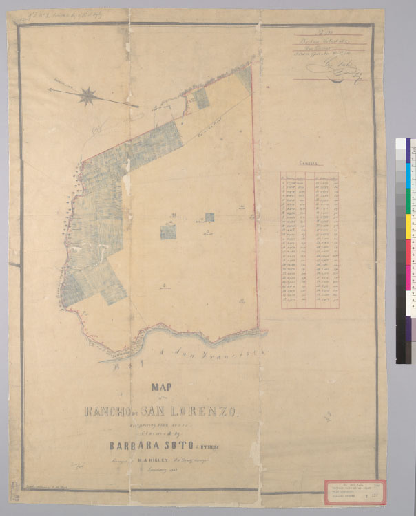
Map of the Rancho de San Lorenzo [Calif.] : comprising 6,332 acres, claimed by Barbara Soto & others / surveyed by H.A. Higley, U.S. Deputy Surveyor, January 1854Description:
Pen-and-ink and watercolor on tracing paper.From: U.S. District Court. California, Northern District. Land case 300 ND, page 322; land case map E-597 (Bancroft Library). Barbara Soto, et al., clmts."No. 524, Barbara Soto, et al. San Lorenzo. Filed in office Nov. 30, 1854, Geo. Fisher, secy.""R.T. no. 2, annexed to dep. of H.A. Higley."Shows drainage, survey markers, boundaries, roads, buildings, land ownership, etc.Relief shown by hachures.4362 S2286Oriented with north toward the upper left.Includes table of boundaries.Creator/Contributor:
Higley, H. A. (Horace A.), authorUnited States. District Court (California : Northern District). Land case. 300, Related Name Indexing Term