[Diseño de la costa de San Francisco : a tract 800 varas square in San Francisco County, Calif.]
Description:
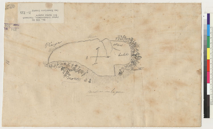
4364 S5In pencil and pen-and-ink.From: U.S. District Court. California, Northern District. Land case 356 ND, page 566; land
case map B-735 (Bancroft Library). Peter Scherreback (or Scherrebech), clmt.Oriented with north toward the bottom.'This grant
is described as " containing eitht[-hundred] varas square on the coast of the Bay from Recon (Rincon) Point in San Francisco
to the mouth of Mission Creek according to the map... and to the original petition for the same.''On this map the compas is
about 90* [degrees] off, North being towards the left hand portion of the map or in the direction of the "E" on the compass.''The
Playa is the beach area of Mission Bay. The Northern most point is probably Rincon Point. The Estero on the eastern side of
the map is (over) either mission Creek or some other creek which leads to an Embarcadero Immediatly [sic.] East of this grant.'
Creator/Contributor:
United States. District Court (California : Northern District). Land case. 356, Related Name Indexing Term