Courtesy of UC Berkeley, Bancroft Library
Title:
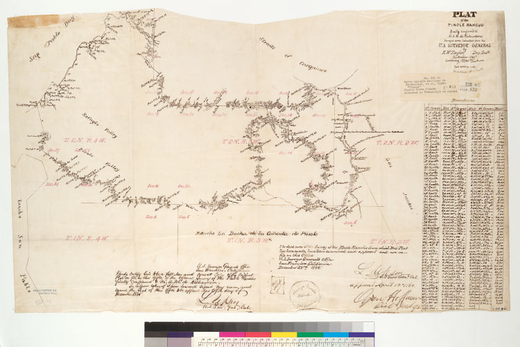
Plat of the Pinole Rancho [Calif.] : finally confirmed to M.A.M. de Richardson / surveyed under instructions from the U.S. Surveyor General by K.W. Taylor, Dep. Surr., September 1865Description:
4362 P475Shows drainage, survey markers, boundaries, township and section lines, adjoining ranchos, etc.From: U.S. District Court. California, Northern District. Land case 205 ND, page 673; land case map E-453 (Bancroft Library). Maria Antonia Martinez de Richardson, et al., clmts.Relief shown by hachures.Includes table of boundaries and Surveyor General's certifications.Pen-and-ink on tracing cloth.Creator/Contributor:
Taylor, K. W. (Kirk White), authorUnited States. District Court (California : Northern District). Land case. 205, Related Name Indexing Term