Courtesy of UC Berkeley, Bancroft Library
Title:
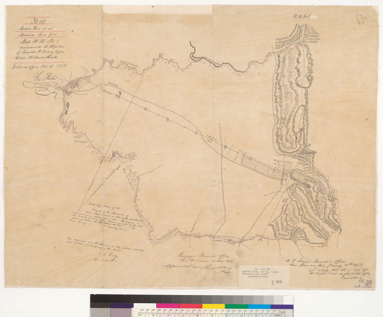
Initiatory survey of the lands of the "Mission San Jose" [Calif.] : under an order of the U.S. Land Commissioner dated April 1, 1852 / surveyed in the month of May 1852 under an order of the U.S. Surveyor Gena., dated April 28th, 1852 by C.C. Tracy, U.S. Deputy Surveyor.Description:
Includes Surveyor General's certification.From: U.S. District Court. California, Northern District. Land case 407 ND, page 369; land case map E-866 (Bancroft Library). Andres Pico, et al., clmts.Oriented with north toward the upper right."No. 110, Andres Pico, et al. Mission San Jose. Map H.H. No. 1 annexed to the deposition of Charles P. Tracy before Comr. Hiland Hall. Filed in office Feb. 12, 1853, Geo. Fisher, scy."Shows drainage, survey markers, boundaries, township and section lines, salt marshes, etc.Relief shown by hachures.4362 E94Pen-and-ink on tracing paper.Creator/Contributor:
Tracy, C. C., authorUnited States. District Court (California : Northern District). Land case. 407, Related Name Indexing Term