Click image for larger view
Title:
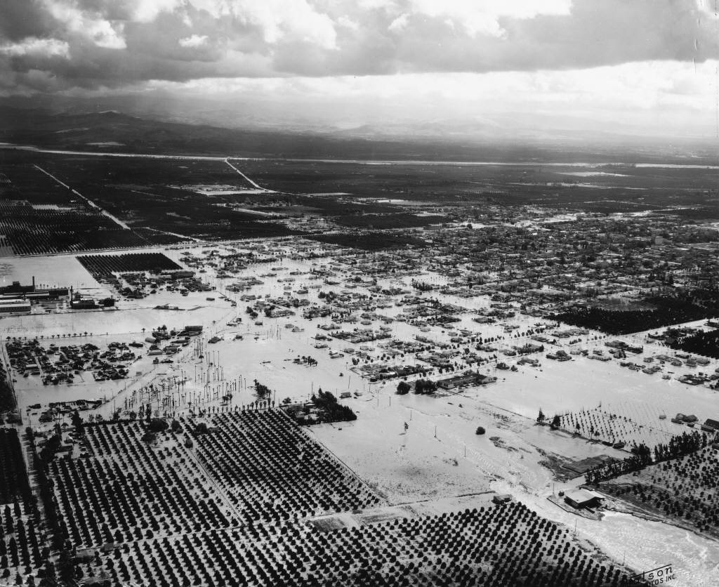
Flood of 1938, Aerial View, Anaheim [graphic]
Digital Anaheim
Description:
Aerial view of the 1938 flood in Anaheim looking east; image shows wide-spread flooding of orange groves and city streets
between Citron Street at bottom of photo to the mountains and Santa Ana River at top of photo; some streets indentified as
Anaheim Blvd. (running diagonally from lower left) and La Palma (running diagonally from lower right.)
Creator/Contributor:
Watson Airfotos, photographer.
Date:
March 3, 1938 (issued)
Contributing Institution:
Anaheim Public Library
More information about this image