Courtesy of UC Berkeley, Bancroft Library
Title:
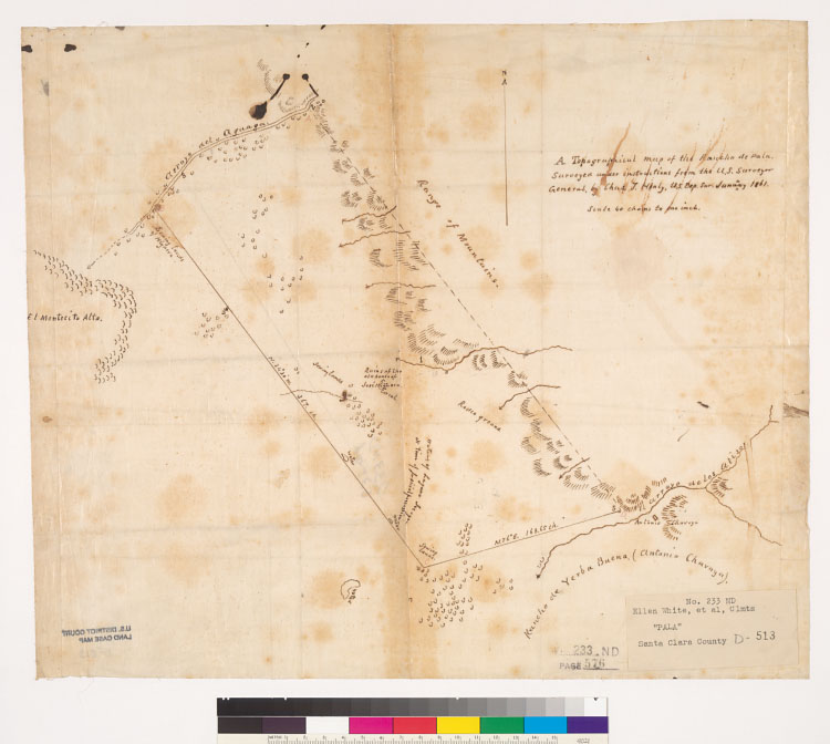
A topographical map of the Rancho de Pala : [Calif.] / surveyed under instructions from the U.S. Surveyor General, by Chas. T. Healy [i.e. Healey], U.S. Dep. Sur., January 1861Description:
Pen-and-ink on tracing cloth.From: U.S. District Court. California, Northern District. Land case 233 ND, page 576; land case map D-513 (Bancroft Library).Covers also a portion of Rancho de Yerba Buena.Shows drainage, buildings, land usage, survey markers, etc.Relief shown by hachures.4362 P13 Y45Creator/Contributor:
Healey, Charles T. (Charles Terraine), authorUnited States. District Court (California : Northern District). Land case. 233, Related Name Indexing Term