Click image for larger view
Title:
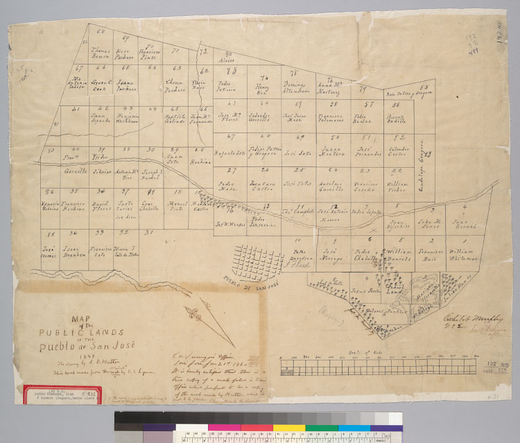
Map of the public lands of the Pueblo de San José , [Calif.] / The survey by J.D. Hutton
Description:
"Exhibit No. 2.""This map made from the original map by C.S. Lyman."Oriented with north toward upper left corner.Cadastral
map showing landowners.From: U.S. District Court. California, Northern District. Land case 192 ND, page 555; land case map
E-431 (Bancroft Library). Pedro Chamoya, clmt.Relief shown by hachures.4364 S6Pen-and-ink.On label attached to map: 2 square
leagues, Santa Clara Co.
Creator/Contributor:
United States. District Court (California : Northern District). Land case. 192, Related Name Indexing Term
Date:
1847
Contributing Institution:
UC Berkeley, Bancroft Library
More information about this image