Courtesy of UC Berkeley, Bancroft Library
Title:
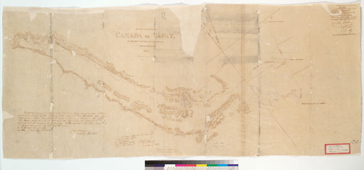
Map of the Rancho del Cañada de Capay, in the county of Yolo, Alta California : containing 39,062.495 acres, 1853-4 / surveyed by Edward RoweDescription:
Pen-and-ink on tracing paper.Oriented with north toward the upper left.From: U.S. District Court. California, Northern District. Land case 382, page 497; land case map F-823 (Bancroft Library). Jasper O'Farrell, clmt."Exhibit 1, annexed to the deposition of Edw. H. Rowe ... ""No. 180, Jasper O'Farrell. Cañada de Capay. Filed in office May 8, 1854, Geo. Fisher, secy."Shows drainage, survey markers, boundaries, land ownership, etc.Relief shown by hachures.4362 C3114Includes Surveyor General's certifications.Creator/Contributor:
Rowe, E. H. (Edward H.), authorUnited States. District Court (California : Northern District). Land case. 382, Related Name Indexing Term