Courtesy of UC Berkeley, Bancroft Library
Title:
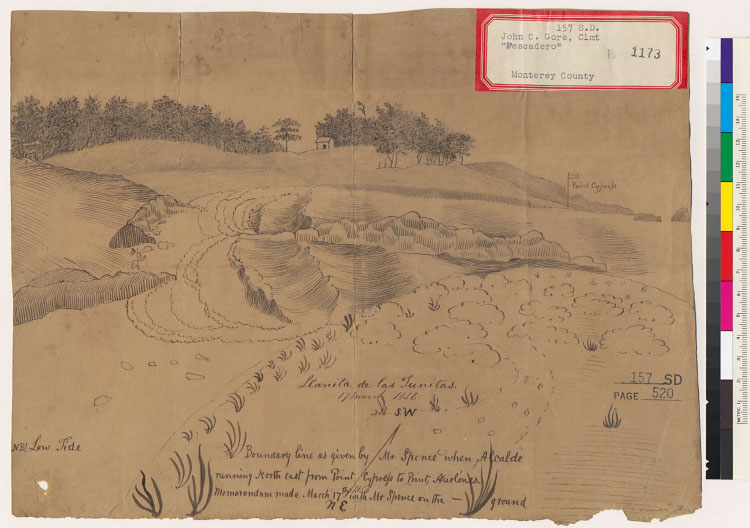
Topographical sketch of Point Cyress, shewing the boundary line of the Rancho de Armenta, or Point Pinos Ranche [sic] [Calif.] : now owned by Dr. A. Randal and Jacob Leese & c., as originally run by David Spence, Esq., Alcalde of Monterey / del. by J.C. Gore, N.A., 1856.Description:
Covers also the Rancho El Pescadero.Relief shown pictorially.4362 E4594 P84From: U.S. District Court. California, Southern District. Land case 157 SD, page 520; land case map B-1173 (Bancroft Library).Pen-and-ink.Title from verso.Text on verso.Oriented with north to the bottom.Creator/Contributor:
Gore, J. C. (John C.), authorUnited States. District Court (California : Southern District). Land case. 157, Related Name Indexing Term