Title:
[Map of the Rancho Los Meganos : Calif.] / surveyed by J.E. Whitcher, Dept. Sur
Description:
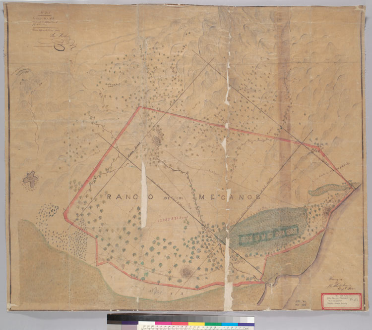
4362 L56Oriented with north toward the upper left.Pen-and-ink, watercolor, and pencil on tracing paper.From: U.S. District
Court. California, Northern District. Land case 107 ND, page 139; land case map F-250 (Bancroft Library). John Marsh, clmt."No.
213, Exhibit no. 1 A.F. annexd to deposition of J.E. Whitcher. Filed in office Oct. 24, 1853, Geo. Fisher, secy."Shows drainage,
boundaries, township and section lines, buildings, acreages, roads, etc.Relief shown pictorially.
Creator/Contributor:
Whitcher, J. E. (Jeremiah E.), author
United States. District Court (California : Northern District). Land case. 107, Related Name Indexing Term
Date:
[1853?]
Contributing Institution:
UC Berkeley, Bancroft Library
More information about this image