Courtesy of UC Berkeley, Bancroft Library
Title:
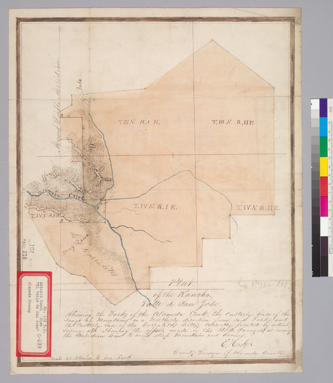
Plat of the Rancho Valle de San José [Alameda County, Calif.] : showing the forks of the Alameda Creek, the easterly base of the range of mountains in a northerly direction from said forks, and the easterly base of the Corralitos hills ... / E.H. Dyer, County Surveyor of Alameda CountyDescription:
Pen-and-ink and watercolor.From: U.S. District Court. California. Northern District. Land case 102 ND, page 218; land case map D-239 (Bancroft Library).Shows drainage, township lines, roads, etc.Relief shown by hachures.4362 V2Creator/Contributor:
Dyer, E. H. (Ebenezer Herrick), 1822-1910, authorUnited States. District Court (California : Northern District). Land case. 102, Related Name Indexing Term