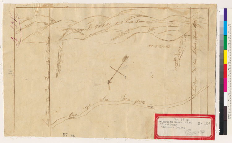
Relief shown pictorially.From: U.S. District Court. California, Northern District. Land case 57 ND, page 134; land case map
B-123 (Bancroft Library). Sebastian Nunez, clmt.Rancho is located along the San Joaquin River in Stanislaus and Merced counties,
rather than in Tuolumne County as stated on label attached to map.Pen-and-ink.4362 O68Oriented with north toward bottom right
corner."The SE boundary is the Garzas Creek. Beyond is public land as far as the Rancho San Luis Gonzaga of Juan M. Pacheco.
See Page 65 of roll.""The NW boundary of the Rancho is the Orestimba Creek. Beyond that is the Rancho El Pexcadero belonging
to Antonio M. Pico. /Between the two is the Rancho La Puerta./""The arrow on this map is 90 [degrees] off to the east. The
arrow actually points eastward to the San Juaquin River. North is about where it is now indicated on the map."
Creator/Contributor:
United States. District Court (California : Northern District). Land case. 57, Related Name Indexing Term