Courtesy of UC Berkeley, Bancroft Library
Title:
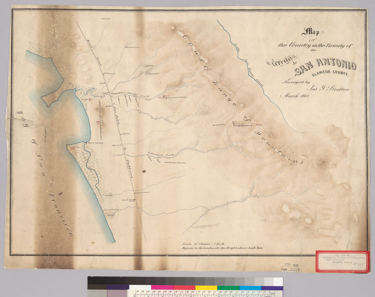
Map of the country in the vicinity of the Cerrito de San Antonio : Alameda County / surveyed by Jas. T. Stratton, March 1861Description:
Relief shown by shading and spot heights.4362 S18Covers the Rancho San Antonio.From: U.S. District Court. California, Northern District. Land case 100 ND, page 2229; land case map E-227 (Bancroft Library). Vincente Peralta, et al., clmts.Shows drainage, roads, land ownership, etc.Pen-and-ink and watercolor.Creator/Contributor:
Stratton, James T., authorUnited States. District Court (California : Northern District). Land case. 100, Related Name Indexing Term