Courtesy of UC Berkeley, Bancroft Library
Title:
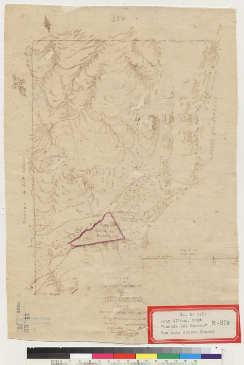
Plan of the Rancho of El Chorro : [Calif.] / surveyed and drawn by W.R. Hutton, surveyor, County of S. Luis Obispo, Nov. 21, 1850Description:
Relief shown by hachures.Oriented with north toward the upper left.Pen-and-ink on tracing paper.Shows drainage, survey markers, boundaries, Huerta de Romualdo, adjoining ranchos, etc.4362 E4586 H75From: U.S. District Court. California, Southern District. Land case 25 SD, page 76; land case map B-978 (Bancroft Library).Creator/Contributor:
Hutton, Wm. R. (William Rich), 1826-1901, authorUnited States. District Court (California : Southern District). Land case. 25, Related Name Indexing Term