Jump to Content
Contributing Institutions
Collection Guides
Browse Map
About OAC
What are Collection Guides?
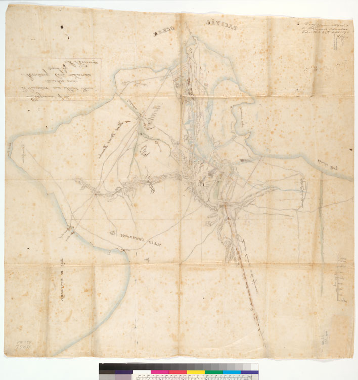
Diagram of the "El Pescadero" and "Point Pinos" Ranchos, and Monterey City Lands : [Calif.] / drawn by J. Ruurds
Diagram of the "El Pescadero" and "Point Pinos" Ranchos, and Monterey City Lands : [Calif.] / drawn by J. Ruurds [verso]
Click image for larger view
previous
image only
image with details
Title:
Diagram of the "El Pescadero" and "Point Pinos" Ranchos, and Monterey City Lands : [Calif.] / drawn by J. Ruurds [verso]
Local Call Number:
Land Case Map F-1175 [verso]
From:
Diagram of the "El Pescadero" and "Point Pinos" Ranchos, and Monterey City Lands : [Calif.] / drawn by J. Ruurds
Collection:
Maps of private land grant cases of California
Contributing Institution:
UC Berkeley, Bancroft Library