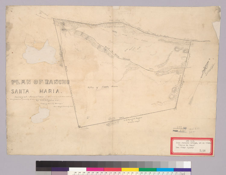
Title:
Plan of Rancho Santa Maria [Calif.] : surveyed June 15th, 1856 in conformity with the calls of the grant as given by Dn. José
Joaquin Ortega and others / by W.H. Leighton, C.E., Acting County Surveyor, San Diego County, Cal
Description:
Shows drainage, roads, boundaries, distances, etc.Oriented with north toward the upper right.From: U.S. District Court. California,
Southern District. Land case 195 SD, page 138; land case map D-1216 (Bancroft Library).Relief shown by hachures.4362 V17Pen-and-ink.
Creator/Contributor:
Leighton, W. H. (William H.), author
United States. District Court (California : Southern District). Land case. 195, Related Name Indexing Term
Date:
1856
Contributing Institution:
UC Berkeley, Bancroft Library
More information about this image