Courtesy of UC Berkeley, Bancroft Library
Title:
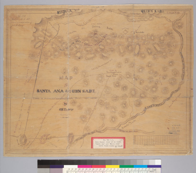
Map of Santa Ana & Quien Sabe : [Calif.] / from a reconnoissance made Dec. 24, 1853 by J.H. Tracy, surveyorDescription:
"No. 22, Exhibit No. 2, A.J. annexed to deposition of Joel H. Tracy."Shows drainage, boundaries, distances, buildings, adjoining ranchos, etc.Relief shown by hachures.4362 S3239Oriented with north toward the left.From: U.S. District Court. California, Southern District. Land case 258 SD, page 135; land case map E-1304 (Bancroft Library).Pen-and-ink on tracing paper.Creator/Contributor:
Tracy, J. H. (Joel H.), authorUnited States. District Court (California : Southern District). Land case. 258, Related Name Indexing Term