Courtesy of UC Berkeley, Bancroft Library
Title:
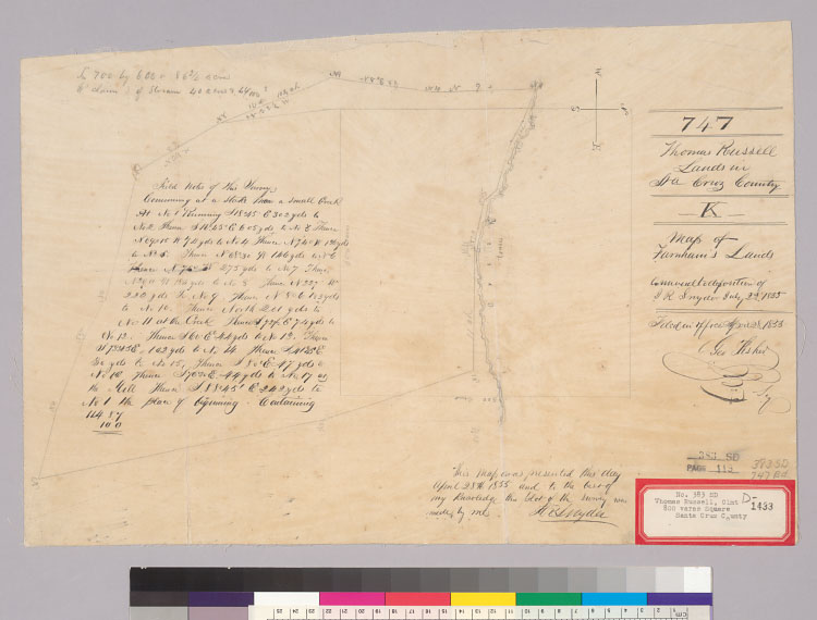
[Plat of the Rancho Potrero y Rincon de San Padro de Reglado : Calif. / J.R. Snyder]Description:
Includes text.Oriented with north to the right.Pen-and-ink and pencil on tracing paper.From: U.S. District Court. California, Southern District. Land case 383 SD, page 119; land case map D-1433 (Bancroft Library)."747, Thomas Russell. Lands in Sta. Cruz County, K. Map of Farnham's lands, annexed to deposition of J.R. Snyder, July 23, 1855. Filed in office April 28, 1855, Geo. Fisher, scy.""This map was presented this day April 28th, 1855 and to the best of my knowledge this plat of the survey was made by me, J.R. Snyder."4362 P68Shows drainage, survey markers, boundaries, etc.Creator/Contributor:
Snyder, Jacob Rink, 1812-1878, authorUnited States. District Court (California : Southern District). Land case. 383, Related Name Indexing Term