Courtesy of UC Berkeley, Bancroft Library
Title:
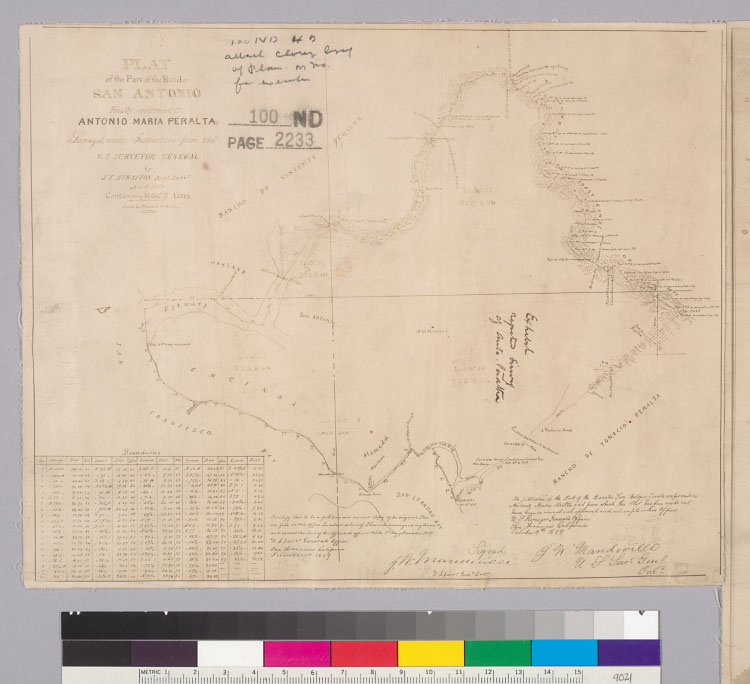
Plat of the part of the Rancho San Antonio finally confirmed to Antonio Maria Peralta : [Alameda County, Calif.] / surveyed under instructions from the U.S. Surveyor General by J.T. Stratton, Depy. Survr., March 1858Description:
Relief shown by hachures.Includes table of boundaries and Surveyor General's certifications.Brown line print of ms. map.Shows drainage, survey markers, boundaries, township and section lines, adjoining ranchos, etc.4362 S18From: U.S. District Court. California, Northern District. Land case 100, page 2233; land case map B-230 (Bancroft Library). Vincente Peralta, et al., clmts.Creator/Contributor:
Stratton, James T., authorUnited States. District Court (California : Northern District). Land case. 100, Related Name Indexing Term