Courtesy of UC Berkeley, Bancroft Library
Title:
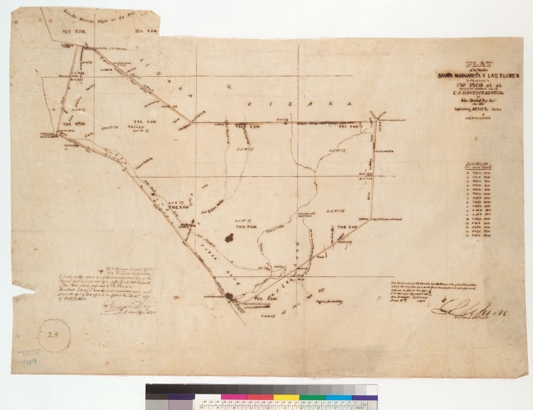
Plat of the Rancho Santa Margarita y Las Flores [Calif.] : finally confirmed to Pio Pico et al. / surveyed under instructions from the U.S. Surveyor General by Max Strobel, Dep. Sur., July 1867Description:
Includes table of boundaries and Surveyor Generals' certifications.From: U.S. District Court. California, Southern District. Land case 317 SD; land case map E-1362A (Bancroft Library).Shows drainage, survey markers, boundaries, lot numbers, township lines, adjoining ranchos, Mission San Luis Rey, etc.4362 S35Pen-and-ink on tracing cloth.Creator/Contributor:
Strobel, Max., authorUnited States. District Court (California : Southern District). Land case. 317, Related Name Indexing Term